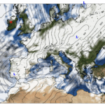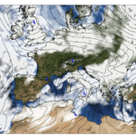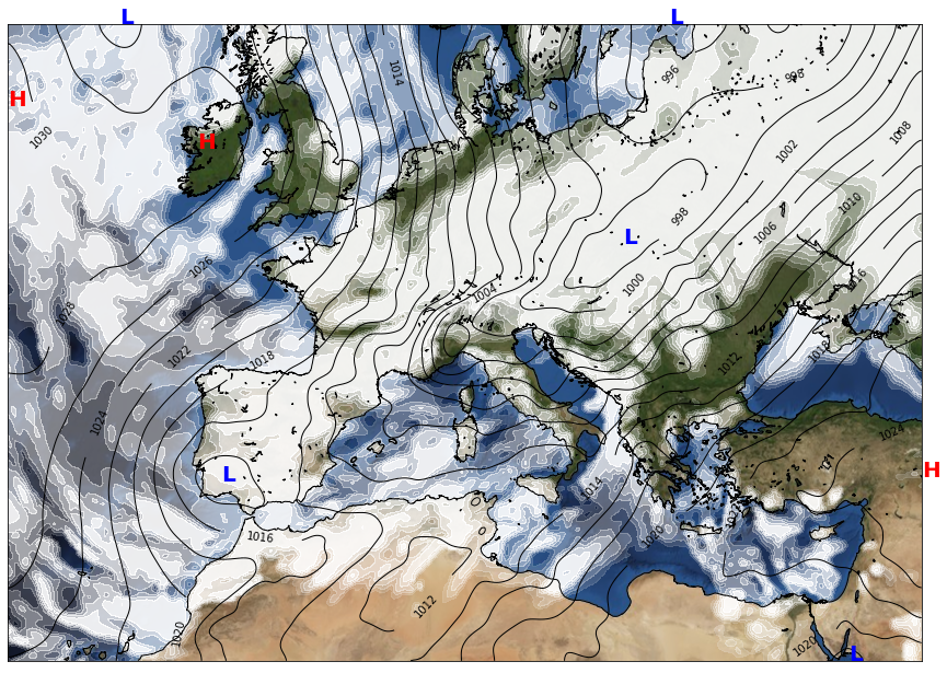
At midday over the wider European and Mediterranean basin, the large-scale circulation paints a very classic late-autumn picture. High pressure dominates both the westernmost Atlantic fringe and the far eastern edges of the domain, while a broad trough stretches across northern and central Europe. This contrast between the strong subtropical ridges to the south and the lower heights to the north drives a lively west-to-east flow across much of the continent.
At 500 hPa, the geopotential height field rises sharply toward the subtropics, exceeding 582 dam across the southernmost latitudes. These warm, high-pressure aloft areas stabilise the air mass over North Africa and the Eastern Mediterranean. Farther north, heights drop toward the 516 dam over Scandinavia, where colder, more cyclonic conditions prevail. This upper-level dip supports unsettled weather across northern Europe, while the Mediterranean rests under more tranquil dynamics.
At the surface, sea-level pressure reinforces this pattern. A strong anticyclonic system near 55°N in the North Atlantic pushes values above 1030 hPa, driving cool and relatively calm conditions into the western maritime areas. Meanwhile, a weaker pressure minimum around the Baltic region nudges values just below 995 hPa, helping maintain cloudier, humid, and breezier weather there.
Cloud cover varies dramatically across the domain. Broad swaths of clear skies stretch from the Iberian interior across much of the central Mediterranean, thanks to stable descending air. Yet pockets of dense cloud — many reaching complete sky coverage — gather over the Eastern Mediterranean, the Black Sea region, and portions of the North Atlantic, where moisture-laden air meets subtle lift. Northern areas from Scotland to Norway also experience abundant cloud cover beneath the upper-level trough.
Temperature contrasts are marked. The coldest conditions at 2 meters dip well below freezing across the Alps, the Carpathians, and parts of Scandinavia, while the warmest air hovers over southern desert-influenced zones, where temperatures climb into the upper 20s Celsius. The vertical thermal structure mirrors this: 850 hPa temperatures plunge below –9 °C over Scandinavia but exceed 19 °C over the far eastern subtropical sector.
Winds at the surface remain light to moderate across most continental areas, with calmer pockets in the Mediterranean basin. Stronger breezes appear in exposed northern maritime regions, where the pressure gradient tightens around the Atlantic anticyclone and the northern low.
Overall, it’s a day shaped by strong meridional contrasts: cool, unsettled conditions in the north; mild, stable, and often sunny weather across the Mediterranean; and pockets of moisture and cloud around the eastern seas. A classic November pattern — dynamic but well-structured across Europe and its surrounding waters.